Zambezi national park and Victoria Falls
Zambezi National Park is a national park located upstream from Victoria Falls on the Zambezi River in Zimbabwe. It was split off from Victoria Falls National Park in 1979 and is 56,000 hectares (140,000 acres) in size. The park is bisected by a road to Kazungula, dividing it into a riverine side and a Chamabonda Vlei side. Most of the park is within the ecoregion of Zambezian and Mopane woodlands, while a small portion in the south is within the Zambezian Baikiaea woodlands.
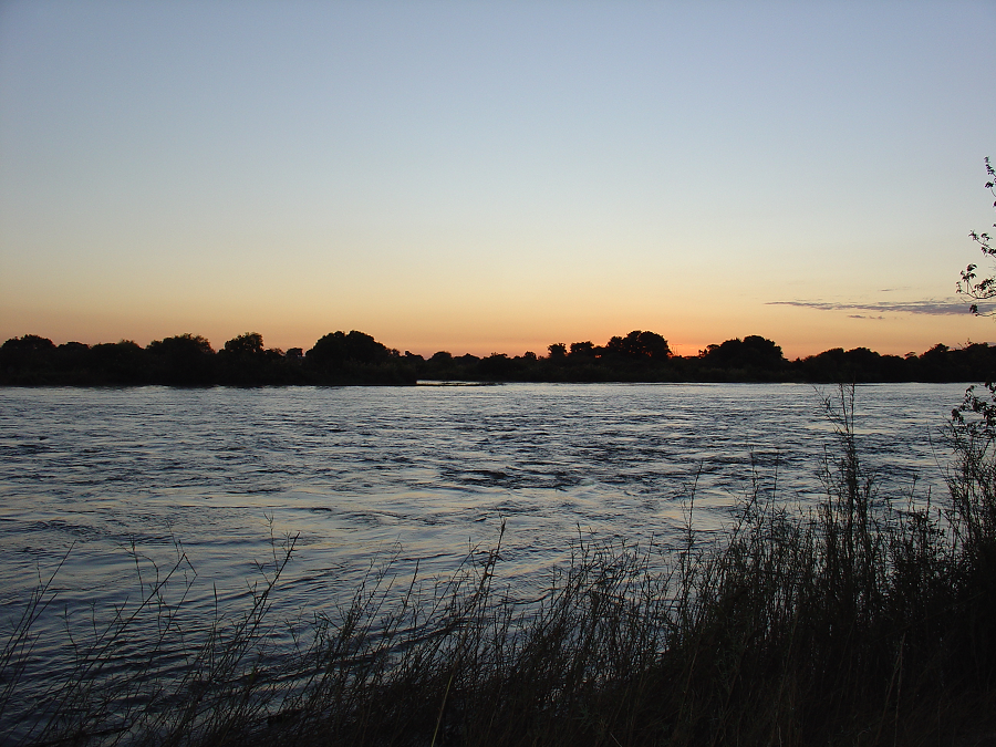
Zambezi National Park together with Victoria Falls National Park cover an area of 56,000 hectares. The northern border of the Park is formed by the great Zambezi River which also forms the border between Zimbabwe and Zambia for much of its length.
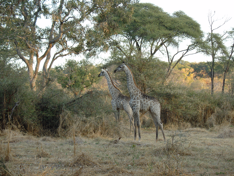
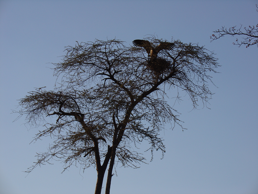
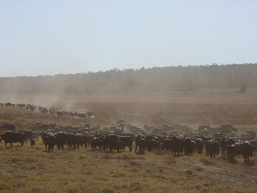
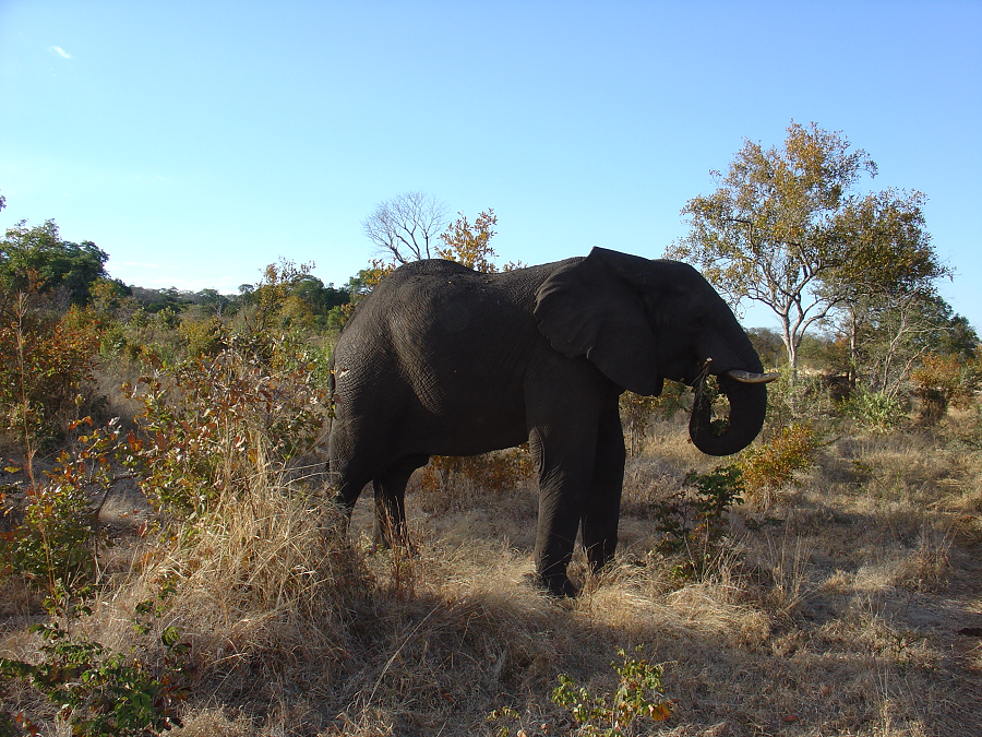
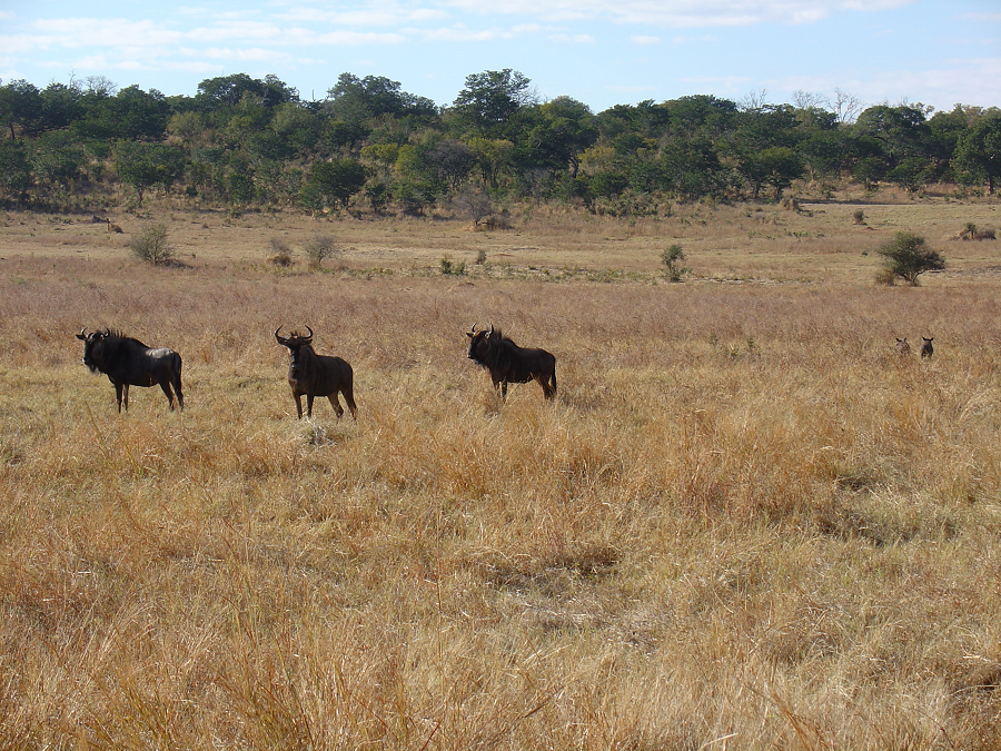
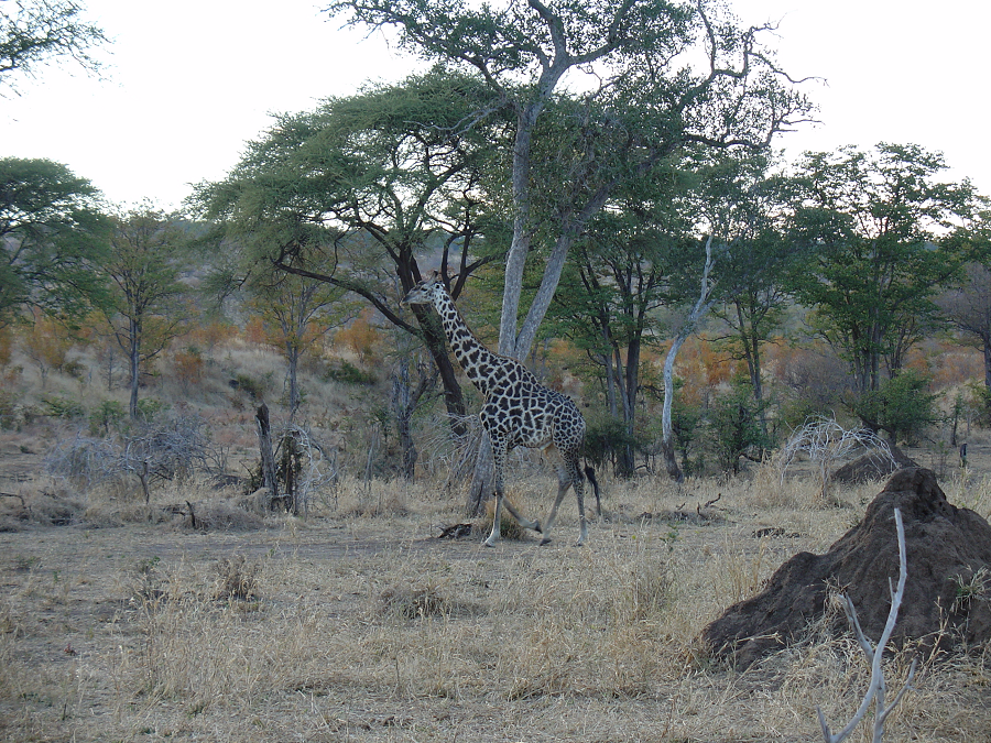
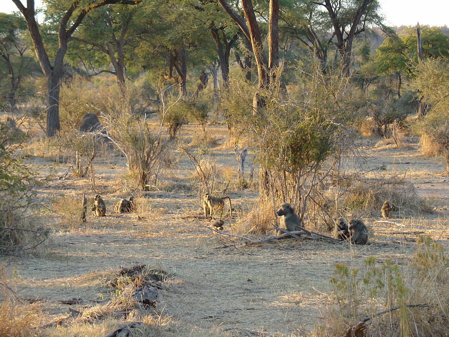
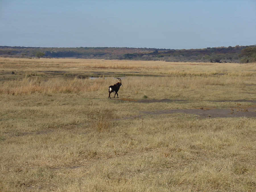
A wide variety of larger mammals may be found within the Zambezi National Park including elephant, lion, buffalo and leopard. In addition, herds of sable antelope, eland, zebra, giraffe, kudu, waterbuck and impala as well as many of the smaller species of game can be viewed.
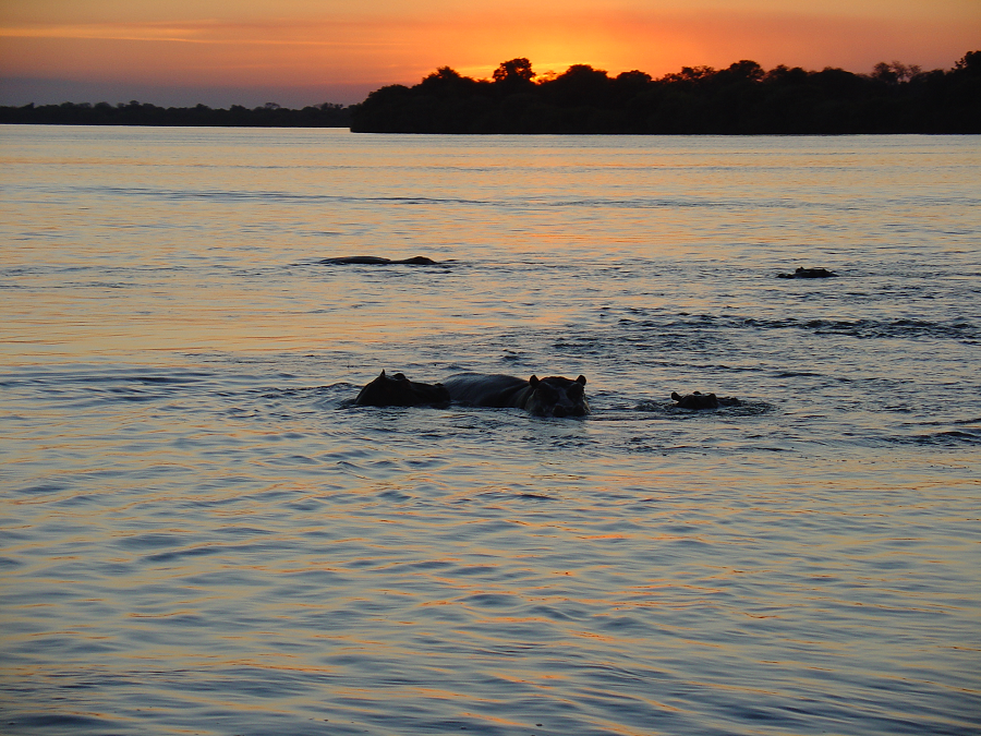
The Zambezi River is home to over is 75 species of fish and is famous for its bream and fighting tiger fish. You can read more about fishing on the Zambezi here.
Zambezi National Park in Zimbabwe has two main game-viewing sections:
The Zambezi River Game Drive, with an extensive network of roads along the river accessed through the main gate of the Park, and the 25 kilometre Chamabondo Game Drive in the southern part of the Park, which begins about 5 kilometres outside of Victoria Falls town – just off the main road to Bulawayo. The roads are in reasonable condition, but please note that they do close the park after heavy rains.
The easiest way to access the Zambezi National Park is via the Zambezi River Game Drive, which is extensive network of roads along the banks of the Zambezi and is accessed through the main gate. There is a 25 kilometre Chamabondo Game Drive that can take the visitor into the wilder the southern part of the Park, and which starts 5 kilometres south of Victoria Falls town; just off the main Victoria Falls to Bulawayo road.
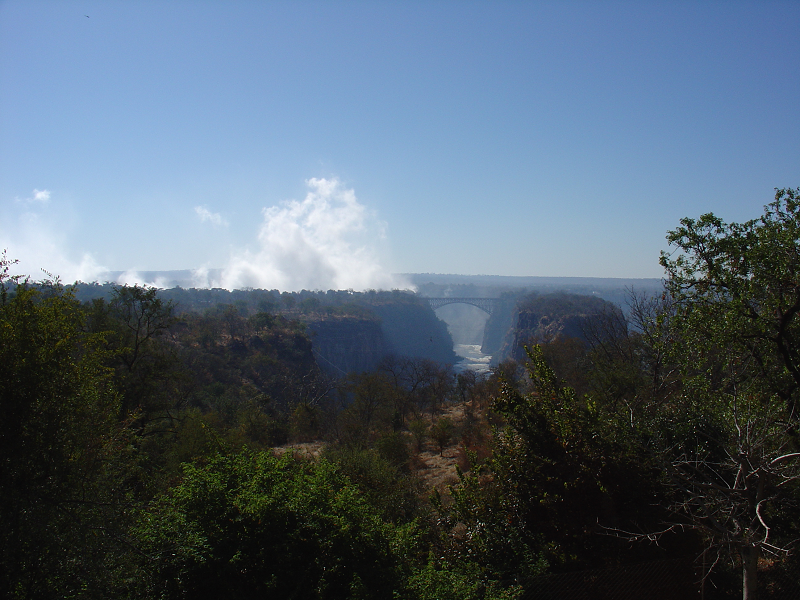
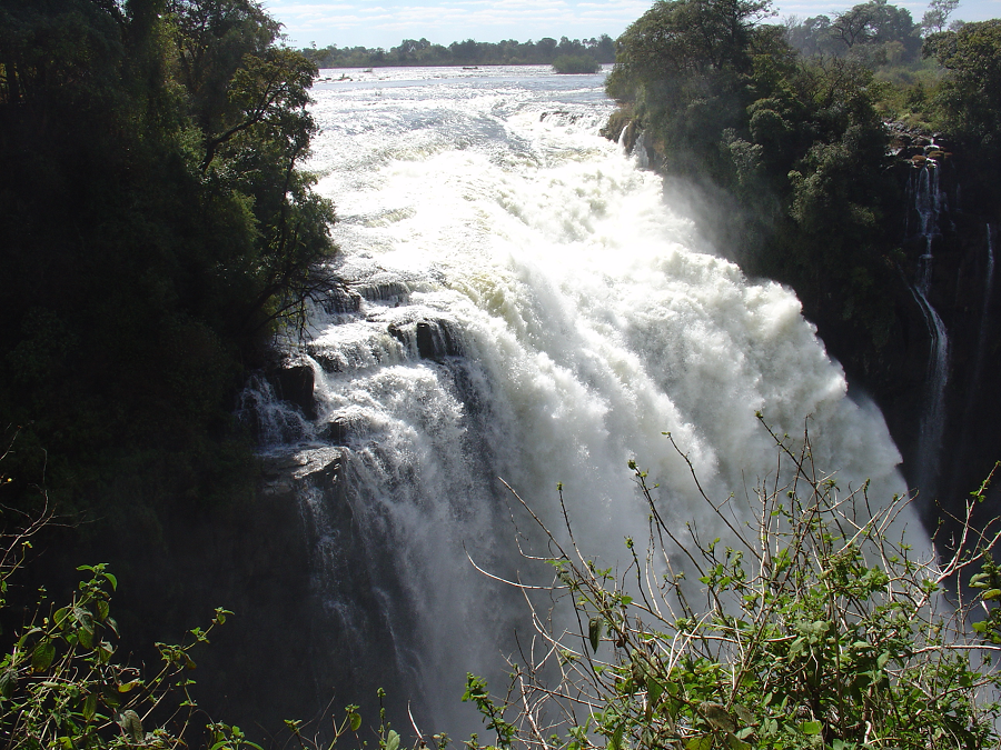
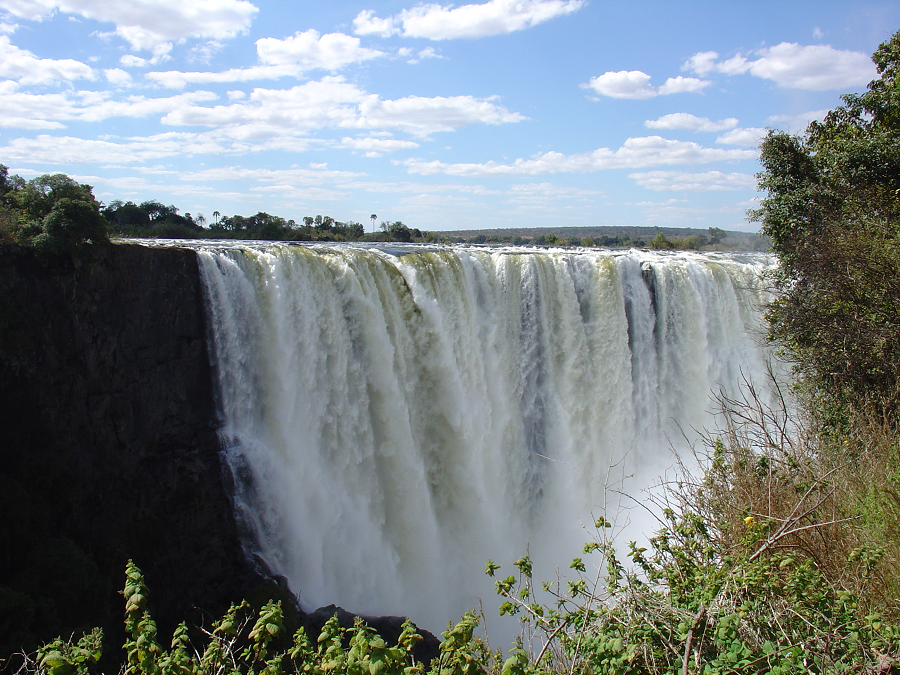
Victoria Falls is a waterfall in southern Africa on the Zambezi River at the border between Zambia and Zimbabwe. While it is neither the highest nor the widest waterfall in the world, Victoria Falls is classified as the largest, based on its combined width of 1,708 metres (5,604 ft) and height of 108 metres (354 ft), resulting in the world’s largest sheet of falling water.
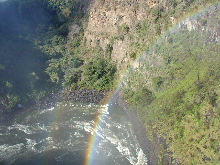
David Livingstone, the Scottish missionary and explorer, is believed to have been the first European to view Victoria Falls on 16 November 1855, from what is now known as Livingstone Island, one of two land masses in the middle of the river, immediately upstream from the falls near the Zambian shore. Livingstone named his sighting in honour of Queen Victoria of Britain, but the indigenous Lozi language name, Mosi-oa-Tunya—”The Smoke That Thunders”—continues in common usage as well. The World Heritage List officially recognizes both names. Livingstone also cites an older name, Seongo or Chongwe, which means “The Place of the Rainbow” as a result of the constant spray.
The nearby national park in Zambia is named Mosi-oa-Tunya, whereas the national park and town on the Zimbabwean shore are both named Victoria Falls.

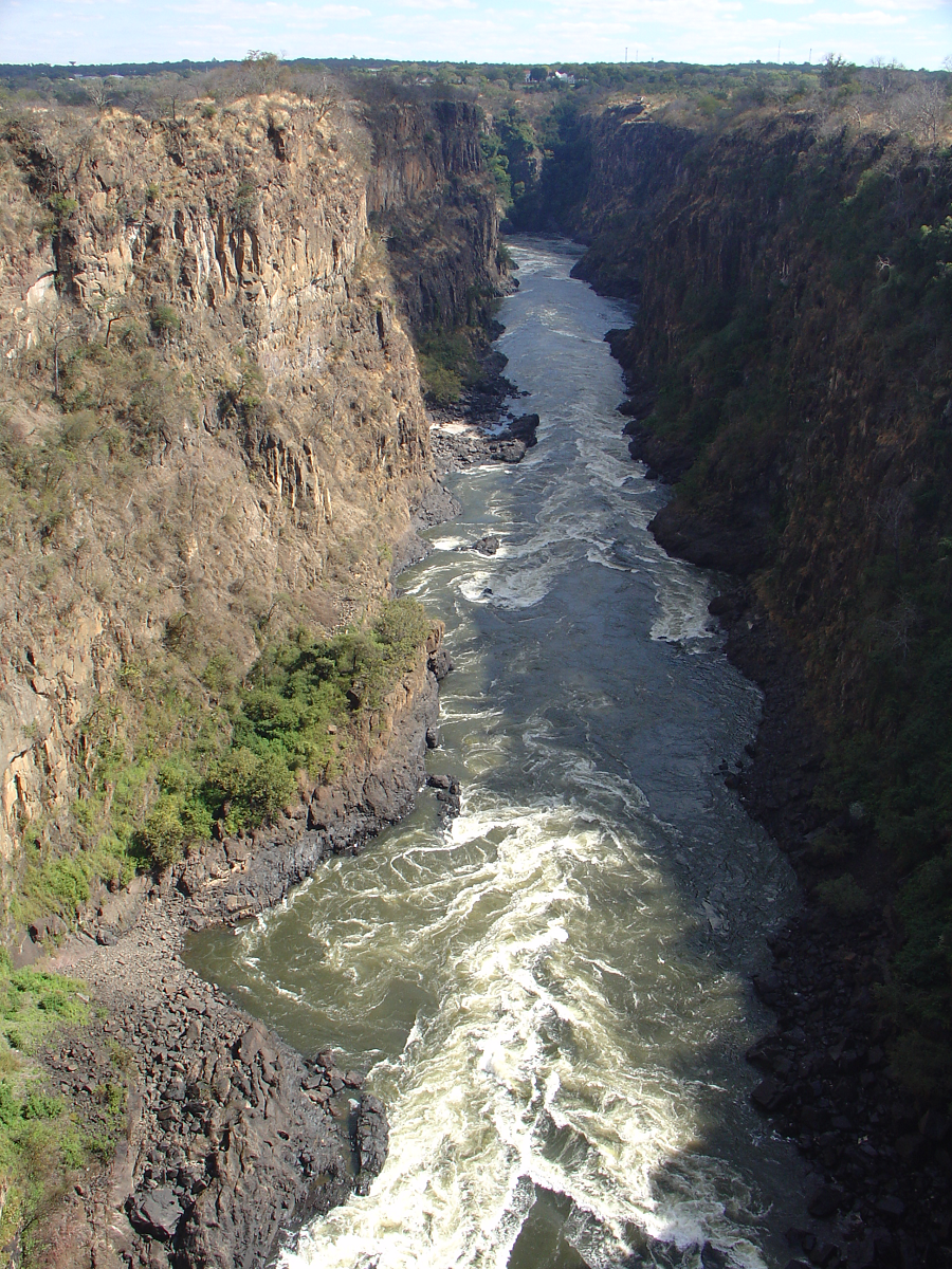
The Zambezi (also spelled Zambeze and Zambesi) is the fourth-longest river in Africa, the longest east-flowing river in Africa and the largest flowing into the Indian Ocean from Africa. The area of its basin is 1,390,000 square kilometres (540,000 sq mi), slightly less than half of the Nile’s.
The 2,574-kilometre-long river (1,599 mi) arises in Zambia and flows through eastern Angola, along the north-eastern border of Namibia and the northern border of Botswana, then along the border between Zambia and Zimbabwe to Mozambique, where it crosses the country to empty into the Indian Ocean.